Wednesday, August 7, 2019

C&O Canal: Day 2

This post refers to events that occurred on Saturday, July 27, 2019.

Yesterday, just before leaving Little Orleans, I had turned on the GPS on my Gaia app. This is a free app that is suitable for hiking, biking, and other outdoor activities. Yesterday's route, according to the official maps provided by the towpath was approximately 41 miles. With some of the meandering we did and the ride into town my Gaia app stated we had done 44.4 miles.

Although the Red Roof Inn itself didn't have much going for it (except for the fact that they recommended that the bikes be taken into our room and that they were used to cleaning all the mud and other dirt falling off bikes in the room), but the coffee in the lobby was just outstanding. I got myself a cup, pulled my chair out of the room and sat outside to watch a beautiful day dawning.
Dawn from just outside our room.
Another nice (co-incidental) thing about the hotel was that there was a Waffle House just next door. We got ready and had an excellent breakfast there. Pulled the bikes out and loaded them to be off for another ride.


On the day that Kedu and Rohit arrived at my place, we had reached out to our friend Vanita -- who is an outdoorsy person -- and asked her if she wanted to join in. She was very excited about the whole thing. Only thing: I didn't have any more bikes to share, so she had to get/rent her own. After some research we concluded that the best way to do this was to have her meet us in Sheperdstown, WV which is on the way today and has a bike shop where she could gear up. She had called the bike shop ahead and found out about it all. We decided to meet her at about 1:00 pm. Today's ride was going to be another 40+ miles and Sheperdstown was about 28 miles from Williamsport. With an average speed of about 7 minutes to a mile, it would take us about 3.25 hours of riding to get there. 

We rode back to the towpath, but reached the detour from yesterday. The detour required us to carry our bikes up and down a wooden bridge. The National Park Service that owns and maintains the towpath had done a good job of having a rail on the right hand side of the stairs where the bike could actually ride. After descending the bridge we started off on the towpath at approximately 9:00 am. The first few miles south of Williamsport is perhaps the most beautiful part of the towpath. The canopy of trees that surrounds the towpath is really thick in this region making for a gorgeous tunnel of green.
Just south of Williamsport MD. Both friends are in the distance.
At approx. mile marker 93, we started seeing a bunch of RVs parked under permanent canopies on the RHS. This is all a part of a private members-only club: The Potomac Fish and Game Club. In addition to real-estate that is made available to the club members to park their RVs, the club also has a massive pavilion with picnic benches, refrigerators, kitchen, barbecue pit, etc. We decided to take a quick rest stop here.

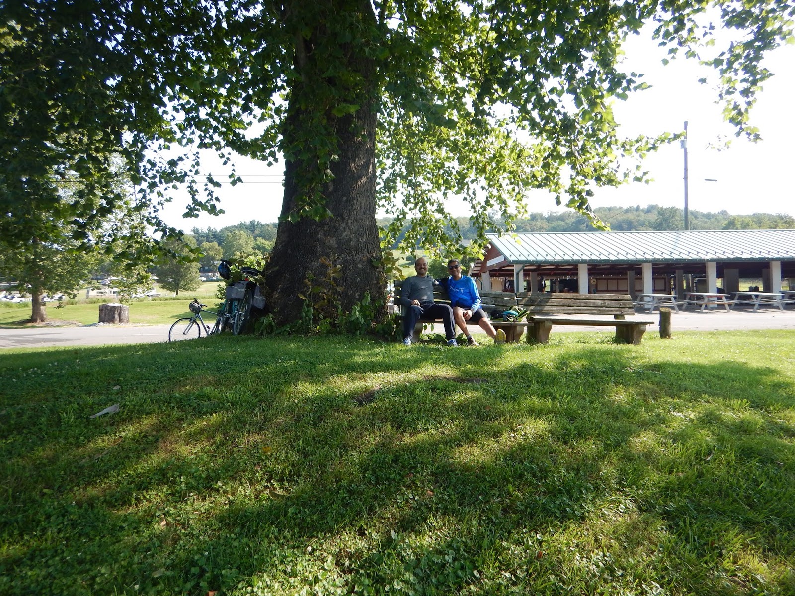
Taking advantage of club bench and tree, pavilion in the background.


View from that club bench.
No sooner had we alighted, an old man on a golf cart who was passing by decided to stop and say hello to us. He had such a broad grin and a friendly face, we got talking to him. He told us all about the history of the club and a little about his life (as a trucker). Apparently, during the last two years the river had completely flooded the area where we were seating. 

He also told us that in about half a mile we would reach the midpoint of the C&O Canal Towpath and there's a marker there -- a must photo opportunity.
As we proceeded southward, the boating, tubing, kayaking, fishing, etc., activities on the river kept increasing:


A little before 1:00 pm we reached the outskirts of Sheperdstown. The towpath gets really rocky here. Unfortunately, we didn't maneuver the rocky parts right: Kedu had a fall and had a small cut on his knee. Our $15 medical kit came really handy here. We were able to clean and sterilize the wound and off we went. To reach Sheperdstown, one has to cross the river on a bridge. 
Bridge over the Potomac to Sheperdstown

There is a series of small switchbacks that take one to the top of the bridge. After crossing the bridge you reach Sheperd University. Despite being a college professor, I had never heard of this university. But the campus and the town were pretty. We were able to locate Vanita quickly. We had lunch at a Thai restaurant, then grabbed Vanita's rental bike and after a quick photo, off we went!
Vanita outside the bike rental shop with her "new" bike.
From Sheperdstown to Harper's Ferry is about 12 miles on the trail. Leaving aside the WMRT, this may be the easiest part of the trail as a lot of it is "raised" on a bed of gravel with a smooth surface (not as smooth as paved, but almost). The bike shop attendant had told us that as you get closer to Harper's Ferry, the river gets closer to the towpath and we would see more and more people tubing, kayaking, etc. How right he was!

Harper's Ferry itself is situated at a confluence of two rivers: the Potomac and the Shenandoah. It has a lot of historical significance for the Civil War and for commerce. The landscape changes a bit as one approaches the town with tall cliffs rising on all the sides of the rivers. The effect is majestic...hard to describe in words.  It's a tiny little town and has a quaint and distinct feel to it. By road, it's only a little over an hour away from DC, but the vibe and the topography of the town might as well make it a few days away from DC.

On a summer Saturday evening we were barely able to get reservations at a local hotel. We rode up to the Quality Inn that is situated on Union Street. The rooms were all deliciously cold with the A/C on full blast. Showered, and took the hotel shuttle to the downtown area where we were lucky to find outside seating with a view:
Harper's Ferry, WV: HQ for the Appalachian Trail

Dinner at The Rabbit Hole
Had some outstanding beers and a lovely dinner, caught the shuttle back to the hotel and off to sleep! My Gaia GPS informed me that we had ridden our bikes 46 miles today. Two-day total: 90+ miles.


Tuesday, August 6, 2019

C&O Canal: Day 1

This post is about Friday, July 26, 2019. The day when we take off for the bike trip has finally arrived. The weather forecast for Little Orleans, MD where we will start our trip is a high of 89F, no rain, but humidity in the 50-60% range. We get up at around 7:00 am, hang out with tea/coffee and I make a run for bagels. Bela makes us पोहा for breakfast -- I swear to you, this is the best friggin' पोहा I've ever had in my life. After a filling breakfast and showers, we load our panniers with our stuff. We distribute the common items among ourselves so that the load is balanced, and check tire pressures on the bikes, load the bikes onto the bike carrier, dump our panniers in my RAV4 and off we go! Kedu, Rohit and myself off on our bike adventure. It's about 10:25 am when we finally head off.
The plan is to drive to Little Orleans, MD and park at a C&O Canal Trailhead there, unload our bikes and ride for about 40 miles until we reach Williamsport MD. There we will stay at the local Red Roof Inn for the night. On the way there, Rohit made reservations for two rooms at the hotel for one night. We stop outside Hagerstown MD at a Subway for lunch at around 12:45 pm. By the time we arrive at the trailhead it's approximately 2:05 pm and the sun is scorching hot. The parking lot is completely exposed and by the time we unload the bikes and install the panniers, we are already hot and sweaty.
Based on the way the shadow of the trees is falling, I mentally come to a conclusion on which way is south. I see a biker on the towpath and yell out to him, "Hey, which way is south?!"  He points in exactly the opposite direction to which I was going to head. 😂

Off we go!
Initially, we stopped quickly a couple of times just to make some minor adjustments, but soon enough we were riding at a rate of about 7 minutes to a mile -- which is roughly the average we maintained throughout the trip. After about four miles of riding we came to a spot where there was a boat launch and a small canoe and kayak rental place -- very primitive. But there were kayakers/tubing enthusiasts emerging from the river. They took one look at us and pointed out the fact that we could switch to the Western Maryland Rail Trail (WMRT) which is parallel to the towpath and is paved. The WMRT runs parallel to the towpath for about 25 miles (as of this writing -- it is continually being extended) to the towpath and is much easier to ride. It was about 50 ft. to the east of the towpath and there was a small connecting path that led us to it. Voila!

We had decided to start the first day in Little Orleans because I thought that 40 miles to Williamsport MD would be a reasonable ride for the first day. I think we should've aimed for a bit less on a hot and sultry day like it turned out to be. About 15 miles into the ride, we reached the pretty little town of Hancock MD. We took a short stop there. I checked out the C&O bike shop there: it's a small place but it could be helpful under the right circumstances.
Hancock MD, 7/26/2019, 4:15 pm
The WMRT continues after Hancock for another 10 miles. Right before it ends, there's a sign that says "You might want to turn right here and make your way to the towpath, because otherwise you'll have to take Rt. 56 and that's not easy."  Well, we ignored the sign and continued to the end of the WMRT and took Rt. 56 to the towpath. This was possibly the hardest riding of the day as Rt. 56 had ups and downs and the road was totally exposed. Which isn't fun in 89F heat.

At around 6:30 pm a few miles before our destination for the day we were somewhat wasted. We had to stop to take a water and gel break. On a 10-mile hike a few years ago, I hit the wall at mile 8. The leader of the group had these energy gels in his pack and he shared one with me. I was a new man! The gel contains maltodextrin and a bunch of salts. Taken with water, it really provides a shot of energy and salts to a body that feels it can't physically go on. All three of us had a gel each and some water. Personally, I'm sure it provided us with the energy to go on.
Water and gel break, 6:30 pm.
After about 30 minutes, we arrived at a gorgeous fall in the river. This was our last break of the day.

A little after mile marker 100 on the towpath, we had to take detour into Williamsport. It's a tiny little town with just one hotel: The Red Roof Inn. We checked in and they were able to give us rooms next to each other on the first floor. We stacked the bikes in Kedu's room.
Showered, then off to the pizzeria across the street (which had a beer store right next door) for a cold beer and delicious pizza. Good night!


Thursday, July 25, 2019

Tomorrow, I will bike some parts of the C&O Canal Trail. I've been thinking about this for at least the past two years and maybe even longer. I immigrated to the US in 1984. Prior to that, I used to engage in a fair number of outdoorsy activities in India (not long-distance biking though). Anyway, the years have just gone by what with pursuing graduate school (Master's and Ph.d.), getting a job, getting married, having kids, etc., etc. However, in August 2018 my second and last child made his way to college. Being an empty nester opens up some time for yourself that you never knew existed. One of the main things I wanted to do was to engage in more outdoorsy activities. Finally, everything has come together for this trip to become a reality.

Originally, the plan was to be self-sufficient, i.e., pack food, a tent, sleeping bag, stove, etc., so that we (I and two friends) need not have to rely on reaching a town where we could lodge ourselves in a motel every night. However, that plan fell through because we felt we weren't prepared enough to implement it. Now, it's just biking and crashing in hotels/motels.

To prepare for this hike I had to pull together the following:
  1. Three hybrid bikes that are serviced, cleaned, and tuned.
  2. Three bike racks, for:
  3. Three panniers.
  4. Water bottles with filters. There are water pumps at very reasonable intervals on the trail, but there are some rumors that some of the pumps don't work. Well, if we have bottles with filters, we can draw water from the canal and safely drink it.
  5. Energy gels
  6. A pair of inner tubes for each bike
  7. Bike chamois
  8. Small set of essential bike tools
  9. Some trail snacks
  10. Change of clothes, underwear, socks, nightwear
  11. Flip flops
  12. Toothbrush, paste
  13. Basic medical kit and any prescription medication
  14. Cash, credit card/s
  15. Shoes
  16. Air pump for bike
This is my first post on this trip. I will add more posts with pictures as I progress through the bike tour.